![]()


TIGLIO - FILECCHIO - FORNACI - BARGA (Route B1)
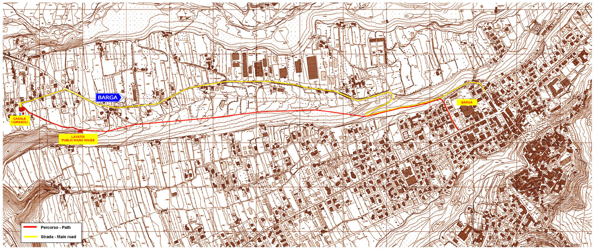
Covered: BARGA - TIGLIO From the Fornacetta, is covered or the grip road on the left of the church continuing then to right in light climb, until to enter on the rotabile, or follows the same rotabile, until finding, to right, one tightened road in reduction (marks them); after little meters a crossroad, we take on the left the way that continues plane, we exceed a first group of houses (the Greenhouse), we arrive therefore the Giuncheto locality, where it begins the old road, used a time with the mules, that it connected Barga to Tiglio. A torrent is exceeded on bridge in stone, meets some houses, one nail head (Jump of the Devil), therefore an other small torrent; it begins hour the climb towards the country of Low Tiglio (542 s.l.m.). Caught up the small public square of the country (with Fontana, ca. 1 hour) we can choose the routes: Distance: 9 Km.
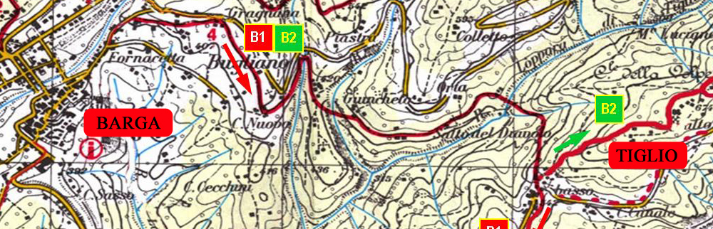
FILECCHIO - FORNACI - BARGA (Route B1)
A) to go up until the castle of High Tiglio (670 s.l.m. - with wide panorama and important works in the church), using the main road or a path, therefore or to return behind towards Barga or to continue towards Filecchio-Loppia-Fornaci. From the small public square the road is caught up salting on the left between the houses, then or it is continued to right for road asphalted, or the visible path on the opposite side of the same one, little meters on the left. B) to continue the distance towards Filecchio-Loppia-Fornaci. From the small public square we turn to right and, after little tens of meters, we find a road asphalted that we will follow to right, in reduction, until the periphery of Filecchio (ca. 1h). We follow the white man-red signs towards the old path that will lead to us to Loppia (15) and to its splendid Romanesque Pieve. From the Pieve we follow the road asphalted that goes more ahead on the Provincial one, that we follow on the left, until catching up the historical nucleus of Fornaci di Barga (160 s.l.m. - 20). To right of the church of the SS Name of Maria, it knows them one tightened road, than it will bring back to us to Barga. It is begun to go up then, before on road asphalted on earth. To a crossroad to follow the path of right (marked), little after there is the short one drawn that it demands a minimum of attention, some scalini of struck earth are gone up, then one short steep road in stone us door between two houses: on the left it is arrived to a asphalted road (we can follow this) that Hospital passes in zone, but above all to the near church of Saint Francisco (beautifulst works of Of the Robbia) and reaches therefore the center of Barga; or villa is continued along the old road, passing of Blond to the old forehead; joints to a asphalted road are continued on the left for approximately 300 meters, then newly to right on mulattiera until intercrossing the rotabile, in loc. Panorama, 200 meters from the large square of the Pit. Distance:
BARGA - RENAIO - BARGA (Route B2)